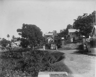
 The negative stigmas which haunt the Laventille community today do a disservice to the generations gone before since they eclipse a proud identity. La Ventille or La Ventilla (the window) is so called because of its breezy outlook perched on hills to the east of Port-of-Spain. Although now demoted to lowly use as a repeater site for the police radio units, there is a low breastwork of stone on a hill known as Fort Chacon. Hardly military in nature, being just a one-gun battery when it was erected in 1792, this was the spot from whence astronomer Don Cosmo Damien Chucurra surveyed the first accurate meridian of the new world by observing the stars in the clear night sky, as yet unobscured by light pollution. This was one of the last places where the soldiers of the island held garrison when the British, under Sir Ralph Abercrombie, seized it from Spain. More than a century after this surrender, little remained of Fort Chacon as this description shows: “The fort is hard to find, for the jungle has crept too zealously around it. It lies in the eternal shadow of green trees, while so overgrown is it with brambles that it might be a barbican of the Palace of the Sleeping Beauty. Like a secret rendezvous in a wood it is approached by a path known to few. This last stronghold of Spain, this redoubt of the dead, is a sturdy little place of grey stone, well and solemnly built. Its walls are of astounding thickness; its paved court that once echoed with the clang of arms is now a wild garden, a mere tangle of green, a court whose silence is broken only by the patter of rain and the song of birds.” In 1803 the strongman British military governor, Thomas Picton, erected another fortification in the shape of a Martello Tower (a rare piece of architecture in the Western Hemisphere). Called Picton’s Folly, the structure was a flop since its rifle loopholes in the thick walls pointed inland instead of at the coast from where any enemies were likely to originate. An attempt made in the 1820s to make Laventille a plantation district failed as Dr L A A DeVerteuil recounted in 1858: “No whites can live there; the coloured people suffer much, and Africans and Chinese are the only people who enjoy comparatively good health. It is assumed that a white man who sleeps one night on the Laventiile heights must necessarily get fever. If correctly informed, a certain number of white families from Dominica and St Lucia were induced by Sir Ralph Woodford to settle on the Laventiile hills and establish coffee estates. In less than eight years they were mowed down by fever, and coffee cultivation was abandoned.” Until a leper asylum was opened at Cocorite in 1840, Laventille was the place where those unfortunates resided, being outcasts of society. A few people of colour and suspected runaway slaves lived here in the pre-emancipation era as well. After Emancipation in 1834 the population of Laventille grew since it was close to Port-of-Spain. The city was one of the most prosperous in the West Indies. The thriving mercantile sector in Port-of-Spain required skilled and unskilled labour and this is where the newly emancipated Afro-Trinidadian found employment. The men went to work as labourers, blacksmiths, carpenters, coopers (barrel-makers), or masons while the women were employed as domestics. In the 19th and early 20th centuries Laventille was a veritable “Carrara of Trinidad.” The blue limestone of Laventille found its way into the walls of most of the prominent buildings of the period. The stone was easy to work, handsome and durable. The raw material was dug out in slabs, and carted down to the building sites where skilled stonemasons would cut and trim smaller pieces which fit together like jigsaw puzzles. A close inspection of the older edifices of Port-of-Spain would give one an idea of how solidly these stones were fitted, as many were set without mortar. Laventille limestone was used in the reclamation of the PoS harbour. The last great use of Laventille limestone was in the construction of the Churchill-Roosevelt Highway in 1942, which was the great road built by the American Army to ease transit between PoS and its base at Fort Read in Cumuto. Today, if one cares to look, the chasms of the old quarries may be seen near the top of Quarry Street. Source: Virtual Museum of T&T
0 Comments
Leave a Reply. |
T&T news blogThe intent of this blog is to bring some news from home and other fun items. If you enjoy what you read, please leave us a comment.. Archives
May 2025
Categories
All
|

 RSS Feed